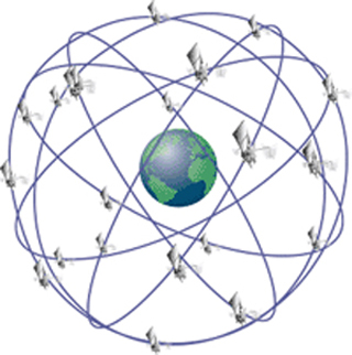
A minimum of 24 GPS satellites orbit the Earth at an altitude of approximately 11,000 miles providing users with accurate information on position, velocity, and time anywhere in the world and in all weather conditions. (Image courtesy of FAA.)
Instructor(s)
Prof. Thomas Herring
MIT Course Number
12.215
As Taught In
Fall 2006
Level
Undergraduate
Course Description
Course Features
Course Description
This course introduces the concepts and applications of navigation techniques using celestial bodies and satellite positioning systems such as the Global Positioning System (GPS). Topics include astronomical observations, radio navigation systems, the relationship between conventional navigation results and those obtained from GPS, and the effects of the security systems, Selective Availability, and anti-spoofing on GPS results. Laboratory sessions cover the use of sextants, astronomical telescopes, and field use of GPS. Application areas covered include ship, automobile, and aircraft navigation and positioning, including very precise positioning applications.


